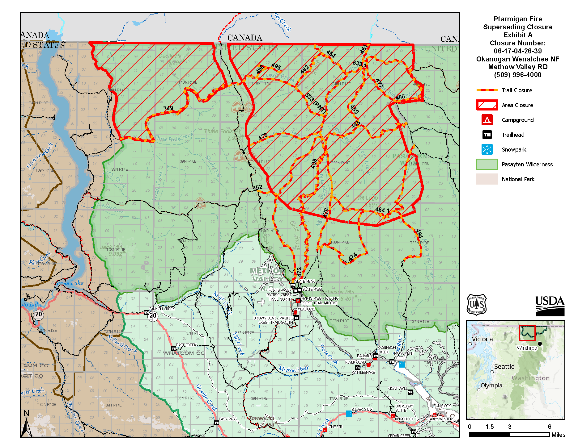
Ptarmigan Fire in Pasayten Wilderness
The PCT is closed north of Harts Pass to Canada. Specifically, the closure starts at mile 2626.2 near the Harts Pass - Pacific Crest North Trailhead.
Detour to the international border at Park Pass
Reaching the Northern Terminus of the PCT is monumentally important to so many. We understand that this is a huge impact on people’s plans. We’re so sorry. It is reasonable, cautious and of course, perfectly acceptable to end your hike at Harts Pass. If your heart desires, and smoke and your situation allows, you may choose to walk this detour to Park Pass near the Canadian border. Please stay on trail when you reach Park Pass. Don't walk cross country. Avoid damaging plants and causing erosion with your footsteps. Do not camp here or create impacts. There is no monument at Park Pass. Please do not build one. Do not impact this special area – leave no trace at the highest level. Do not cross the international boundary line as marked by the border cut seen in the distance. Be careful! Once you leave the PCT, things change. It’s fire season – take the risk seriously. Prepare, leave a trip and communications plan with your trusted contact, bring maps, and more. - High hunt is in mid to late September, and the Larch Creek Trail will be a hunting destination. It’s important to be aware of this and to wear hunter orange while travelling through this area. - You are more likely to encounter pack strings on this trail and need to be aware: talk to the wrangler about how to step off trail while the horses and mules pass by. - Billy Goat Trailhead receives much less vehicle traffic than Harts Pass, so be prepared to walk back to Mazama or Winthrop unless you have arranged a ride. - Winter is coming. Beware of hypothermia and snow that makes travel impossible. - Don’t get lost. If you don’t have experience navigating off the PCT, we caution against this being your first attempt. Pasayten Wilderness is one of the most remote areas in the contiguous United States.
Detour maps and directions to Park Pass in Pasayten Wilderness
After walking the PCT north from Rainy Pass, take Harts Pass Road down towards Mazama. From there, walk Forest Service roads over Cub Pass and up Eightmile Creek to Billy Goat Trailhead. From there, take trails to Park Pass near the Canadian border. Protect these areas! After months on the trail, we hope you have fallen deeply in love with wild lands and that you embrace “gold standard” actions to protect fragile and special places. Camp in existing sites. Stay on trails. Do not have fires. Do not travel in large groups as the campsites cannot fit many people. Do not build structures – no terminus, no messages, nothing. Thank you. You can view the detour by clicking the "PCT Closure Map" at the top of this page. The smartphone version of the PCT Closures App is available for download on both the U.S. Apple App Store and Google Play Store. If you have it downloaded, you can download basemaps and the detour within the app when you have service. Otherwise, the detour is also available here:
Crossing into Canada is strictly prohibited and a serious violation of Canadian Federal Law. The consequences could result in imprisonment, deportation, and a lifetime ban from Canada. The area around Park Pass is mostly treeless but the border cut can be seen in the distance. Again, do not cross the border.
Distances
- 20 miles from Harts Pass to Mazama via Harts Pass Road - 33.5 mile road walk from Mazama to Billy Goat Trailhead - 19.5 trail miles each way from Billy Goat Trailhead to Park Pass - That’s 73 miles from Harts Pass to Park Pass - And 72.5 miles from Mazama to Park Pass and back to Billy Goat Trailhead - Or, 106 miles if you are walking all the way from Mazama to Park Pass and back. Or, walk to Winthrop which is larger than Mazama.